
Route optimization is an important process for businesses that rely on deliveries, pickups or field services. It involves finding the most efficient way to travel between multiple stops, taking into account factors such as distance, traffic, and delivery time windows. By optimising routes, businesses can save time, reduce fuel costs, and improve customer satisfaction.
Several commercial examples where route optimization can be used include:
- Food delivery services: Companies like Deliveroo and Uber Eats rely on route optimization to ensure that their drivers can efficiently deliver food to customers while minimizing delivery times and costs.
- Waste management: Waste collection companies use route optimization to plan the most efficient collection routes for garbage and recycling, reducing fuel consumption and minimizing the time it takes to complete collections.
- Retail distribution: Retailers with multiple stores use route optimization to efficiently deliver products from their distribution centers to their stores, reducing delivery times and ensuring that stores have the right products at the right time.
- Field services: Companies that offer field services, such as plumbing, HVAC, or electrical repair, can use route optimization to ensure that their technicians can efficiently travel between job sites, reducing travel times and improving customer satisfaction.
Overall, route optimization is an essential tool for businesses that rely on travel to deliver their products or services. By optimizing routes, businesses can improve efficiency, reduce costs, and provide better customer experiences.
ORS Tools is a QGIS plugin that includes the Directions from points 1 layer algorithm for solving the Travelling Salesman problem. It’s used to determine the fastest route for a courier with multiple stops, as demonstrated in an example below, where a Postal Worker collects mail from 49 postboxes around Bedford’s town centre. The tool relies on OpenStreetMap roads data to create the optimal route. Overpass Turbo is a web-based data mining tool for OSM that can be used to export a geojson data file, and its corresponding query.
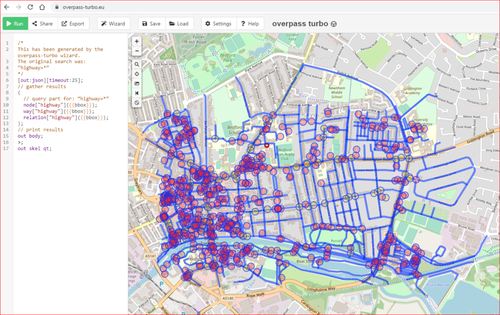
Used in conjunction with the OSM Wiki, query terms can quickly be tested using the “wizard”, when the required results are determined they can be exported as geoJSON files which can be dropped onto a QGIS canvas for analysis.
The tool dialog is shown below with the required layers and parameters.
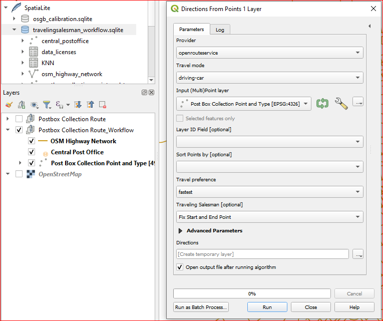
Labels denoting the order of postboxes to visit were added after visually confirming the route and checking that traffic regulations are complied with. The GIS returned the route length as 24.7 km with a drive time of 1.1 hrs.